Walking and cycling routes

From paths beside the sea to the gorges of the Picos de Europa.

Updated 2 sources cited

The essentials

  • Asturias has routes for every level: one-hour strolls, mountain crossings and greenways suitable for bicycles.
  • The greenways (former mining railway lines) are flat, firm and perfect for families.
  • The Cares Trail is spectacular but exposed: check its status before you go.
  • The Camino Primitivo (154 km) can be walked in single stages.
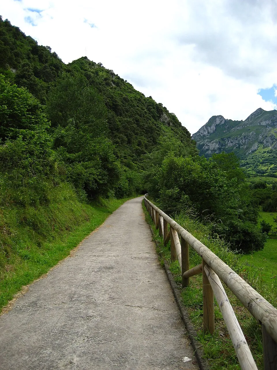
The Senda del Oso, a greenway through Santo Adriano, Proaza, Quirós and Teverga.
The Senda del Oso, a greenway through Santo Adriano, Proaza, Quirós and Teverga. Photo: Joaquinceb · Public domain · Wikimedia Commons

Walking routes

Cares Trail

Facts
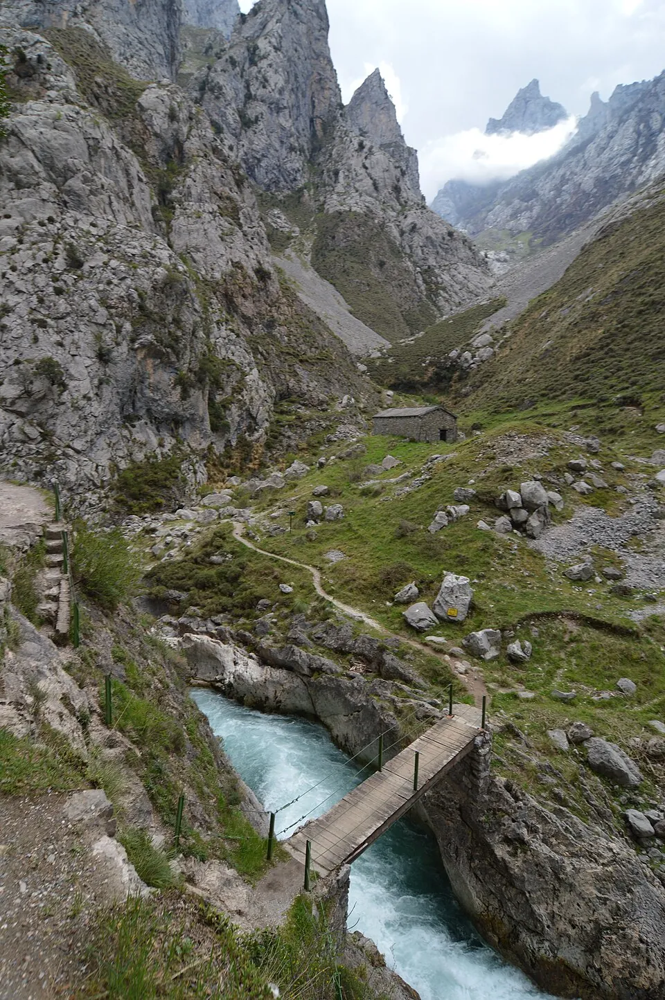
About 11 km each way (22 km out and back) with 831 m of total climbing; over 5 hours, according to Turismo Asturias, which rates it as hard.
Warning
It is a path cut into the rock with exposed sections. A rockfall hit the area at the end of July 2026 and its status can change from one day to the next. Read our Cares Trail guide; the National Park advises extreme attention, avoiding it in rain or strong wind and checking its status before you go.

Covadonga Lakes

Facts
Short walks between lakes Enol and Ercina and up to the viewpoints, suitable for almost everyone.

Senda del Arcediano

Facts
4 to 5 hours with about 700 m of ascent and 600 m of descent (GR 201), according to Turismo Asturias.

Xanas Trail

Facts
An easy path through the gorge carved by the Xanas river, with sheer walls and lush vegetation.

Alba Trail

Facts
A riverside path through woodland and gorges, one of the most popular in Redes.

Llanes coastal path

Facts
About 9 km beside the sea among cliffs and beaches.

Camino de Santiago Primitivo

Facts
About 154 km through Asturias; many people walk it in one-day stages.
The Cares Trail, cut into the rock above the river.
The Cares Trail, cut into the rock above the river. Photo: Javier Mendia García from leioa · CC BY 2.0 · Wikimedia Commons

Cycling routes

Senda del Oso

Facts
From Entrago (Teverga) to Buyera (Santo Adriano) it is 18 km, downhill; with the Quirós and Teverga branches the network exceeds 40 km out and back.

Fuso Greenway

Facts
About 9 km each way (18 km out and back) from the Parque de Invierno to Fuso de la Reina, on asphalt.

La Camocha Greenway

Facts
A little over 7 km each way from Tremañes to the La Camocha mine.

Eo Greenway

Facts
7 km each way (14 km out and back) along a former railway line with an earth surface.
The Senda del Oso.
The Senda del Oso. Photo: Joaquinceb · Public domain · Wikimedia Commons

Practical tips

  1. Check the forecastWeather changes quickly on the coast and in the mountains: look at the AEMET forecast.
  2. Footwear and layersBoots with good grip and a light waterproof, always.
  3. Water and foodOn many routes there are no fountains or cafés halfway.
  4. Plan your transportOn linear routes such as the Cares, organise your return before you set off.

To combine routes with other plans, see the nature parks or plan your trip.

Frequently asked questions

How long is the Cares Trail?

About 11 km each way between Poncebos and Caín. Some stretches are exposed: wear suitable footwear and avoid bad-weather days.

Which cycling route suits families?

The Senda del Oso is a flat greenway, popular with families.

Sources

  1. Turismo Asturias. Ruta del Cares
  2. Turismo Asturias. Senda del Oso